See a World Beyond the Visible—Through a Thermal Lens
Turn thermal data into actionable insight—across industries, environments, and scales.
Locate what’s hidden.
Identify what matters.
Quantify with clarity.
Thermal Imaging Data and Platforms:
Mid-Wave Infrared (MWIR) (3–5 µm)
Long-Wave Infrared (LWIR) (8–14 µm)
Each band unlocks a different layer of reality. Knowing which one you’re using shapes what you see—and how you use it.
Your platform choice shapes your application—spatial resolution, timing, and context all start here.
Satellites
Airplanes
Drones

Thermal Eyes in the Sky
We’ve built the largest open directory of satellites with thermal sensors—past, present, and planned.
Explore specs, revisit times, resolutions, bands, and mission goals.
Looking for the right sensor for your research or project? Start here.
searchable list of 350+ satellites with thermal sensors, from historic missions to upcoming launches.
Real-World Use Cases, Backed by 20k+ Papers
Urban Areas: Heat islands, pavement cooling, climate resilience
Buildings: Heat loss, roof leaks, energy audits
Agriculture: Crop stress, irrigation planning, evapotranspiration
Environment: Wildfires, volcanoes, wetlands, pollution
Wildlife & Health: Animal tracking, injury detection, whale blowhole analysis
Explore real-world use cases that turn temperature into action.

-

Electrical Industry
-

Heat Loss from Rooftop
-

Wildlife Detecting and Monitoring
-

Agricultural Fields
-

Mapping Groundwater and Stormwater Discharge
-
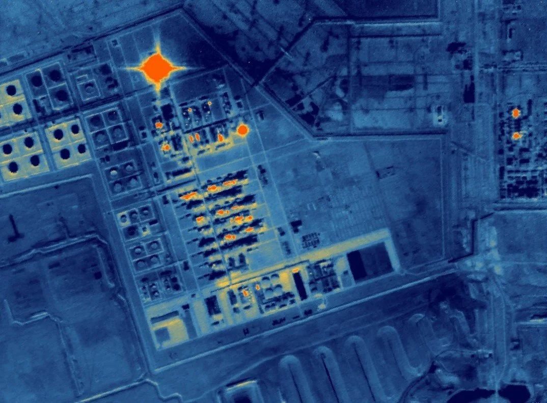
Oil and Gas Industry
Learn Thermography
Thermal imaging is the future. But in Canada? You won’t find it in a single university.
Private training exists—but it’s limited and costs over $3,000.
We saw the gap—so we built the solution.
→ Researched certifications, conferences, and real-world case studies
→ Pulled insights from thousands of scientific papers
→ Designed a course that’s science-based and practical
Learn the fundamentals. Master the tools.
Apply it in buildings, cities, agriculture, health, and more.

Our Services
Support at Every Step of Your Thermal Journey
Whether you're a researcher, student, business, or public agency—we’ve got tools, training, and guidance.
Drone Thermography
Physics-informed DL/ML
Thermal-to-Visible
Image Super-Resolution
Consulting Services
Interactive Thermography Workshops
Research Collaboration